Friday, September 5, 2014

Colorado Trail loop - Day 1

My day started at 3:45 AM when I stumbled out of bed, ate some Noosa yoghurt with granola and sliced banana, filled up my water bladder, slathered a quarter pound of chamois cream on some bike shorts, and rolled out of my garage by 4:15. I'd packed everything else the day before.

The neighborhood was eerily quiet and it was a bit surreal; I've rolled out from the house on a day ride a thousand times, knowing I'll be back raiding the fridge later that day. In this case I had a least four days before I'd be (hopefully) returning under my own power.  Would the fridge still be there to greet me?

It remained too dark for pictures until I reached south Boulder, about 30 miles in, when I was able to catch the sunrise:

Soon after I passed a pair of fawns enjoying the cool morning. No sign of mom though:

Eventually I turned east though the Marshall Mesa area and decided it was time to make the swap from clear to tinted lenses. I'll remember this smooth single track fondly later, there is plenty of chunk in my future:

A view back west. Is there anything prettier than the morning sun on the Flatirons?

When I reached Superior my buddy Joel met me at the Coalton trail head, he was aware of my progress thanks to my Spot satellite tracker. We helped a guy who fell on his bike in the trail head when his tire blew off going over a curb (poor guy broke his hand), then we stopped at a Chick Fil-A where I put down a second breakfast:

Thankfully I'm not travelling with Aragorn so there's no one to deny me a second breakfast. I'll need to eat like a hobbit to keep up with the calorie burn and keep the pedals turning over the next few days. Full of coffee and fast food I continued on with Joel through Superior. We joked it was like a fighter plane flying escort to a bomber, with me on my loaded steel hardtail and Joel on his racy carbon Niner. Joel knew a quick way through town to get to HW 128 and Simms, where I have to spend a few miles in traffic to connect to Standley Lake Park and a nice stretch of double track. It was a real morale boost to see a friend at the beginning of my trip. Thanks again, Joel!

The remaining miles to Golden went by quickly and covered a mix of bike path, double track, and some ghetto single track:

The first real climb of the trip was over the mesa at North Table Mountain Open Space:

The city of Golden and the Coors brewery were just past the mesa:

At this point I had my first schedule dilemma. My sense of urgency and the reason for starting the day at an ungodly hour was so I could reach a certain general store between Tarryall Reservoir and Kenosha pass on Day Two before it closed at 5 PM. This was the only resupply opportunity past Golden until Frisco and it was 30 hours from my current location. I'd hoped to score some real food in Golden but it was only 10:15 AM and nothing was open yet. I considered hanging out but decided I'd be better off if I kept moving. My pile of almond butter and honey sandwiches, Honey Stinger waffles, and drink mix would have to suffice. I did take time to stop at a convenience store to grab a honey bun and refill on water:


Refueled I kept rolling south through town, along the C-470 bike path, through Bear Creek State Park in Lakewood, back to the C-470 path:

and through some neighborhoods in Littleton:

Then I rode around the lake at Chatfield State Park where after getting a bit lost, I found the trail that continues south all the way to Waterton Canyon. I got rained on a bit here, but it was nice and warm compared to the rain I'll see later up high:
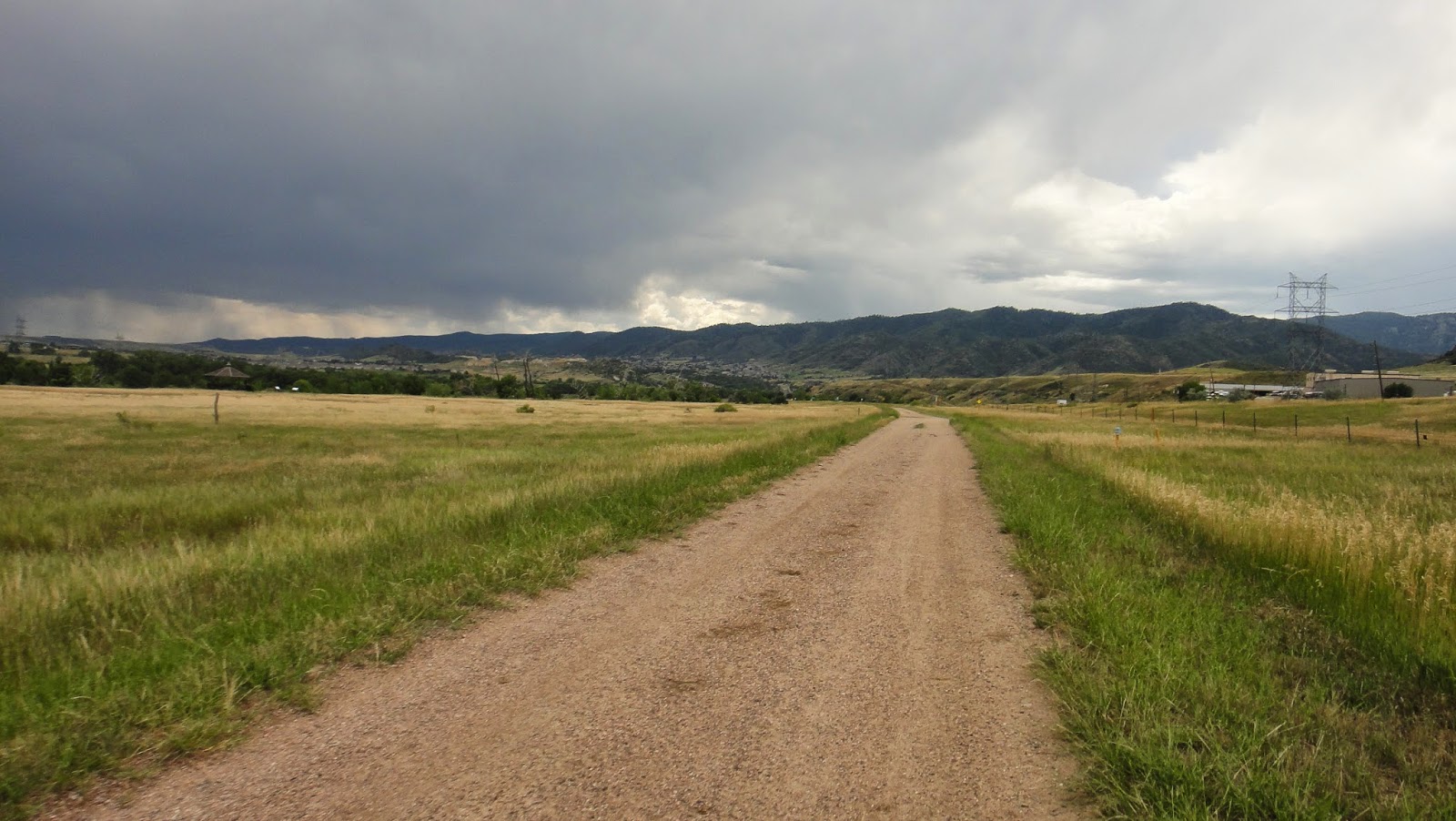
And here I am, 85 miles later, at about 2 PM, and at the end of my warm up. Time to tackle the Colorado trail I'd never ridden segments 1 or 2 and I was excited to cover some new terrain:

Man, this is easy! What's all the fuss about, I thought the CT was hard:

Easy perhaps but gorgeous, the canyon here along the Platte River is amazing. Good fishing apparently, lots of people out with poles:

Lots of bighorn sheep too. This is the closest I've ever come to these guys before:


And I take back the part about the CT being easy, the road gave way to rocky single track all too soon. The following are all from segment 1 and I seem to only have pictures of the rideable parts. There were many unrideable sections, it took me about 3 hours just to cover the 17 miles of segment 1:


At about 5:30 I finished segment 1 at the South Platte and paused to read up on segment 2 in my CT data book info. Segment 2 is 20 miles, most of which goes through a burn area so it's hot and exposed, with no water, so to be safe I top off by filtering from the Platte:


Some representative sections on segment 2. It's hot but fairly rideable with decent flow:


I finished segment 2 just shy of sunset, which was my goal for the day. I'm tired after 16 hours of riding, but happy with my progress. At this point I need water, I'm hungry, it's getting cold, I need to find a place to camp, and I have very little light left. Checking my photocopied pages from the CT data book I realize there is water just a mile further on into segment 3 and that there should be flat spots for camping just past that. I chow some food, put on warm clothes, and keep plodding forward. I filter in the dark, find a likely camping spot, and nearly stumble over a camper in his bivy, the first person I've seen in in several hours. Embarrassed, I continue a few hundred feet down the trail to another good spot, set up camp, crash, and dream of burritos.

Colorado Trail loop - Overview

Over the past winter I did a lot of route research and hatched a plan for a big bikepack trip that would be the focus of my 2014 riding season. My criteria were as follows:
  1. Make it logistically simple by requiring no pick up or drop off and no support
  2. Include the Colorado Trail
  3. Step up the difficulty level a bit from the Nederland to Crested Butte trip I did last year
  4. Invite others but be prepared to go solo
  5. Have fun
Arguably one or more of the first four criteria preclude the fifth but that's a matter of opinion. The most difficult things in life are usually the most rewarding, right? Even if it's not fun at times in the moment, no doubt I'll swear it was fun later when the memory of pain fades.

Eventually I ended up with the following plan. Starting from my front door in Longmont, head to Waterton Canyon, ride segments 1 through 6 of the Colorado Trail to the Breck/Frisco area (with the long, official detour south around the Lost Creek Wilderness), then loop back home. At first I figured I'd take bus and light rail from Longmont to south Denver, but after further research I pieced together a decent, low traffic urban route, and decided to just bike the whole thing. I even pre-rode the Boulder to Chatfield State Park section with some friends in the spring on a two-day "Loop around Denver" ride, which was pretty awesome in and of itself.

I also decided to time my ride to roughly coincide with the Colorado Trail race. I ended up timing it perfectly and ran into several of the race leaders, including the eventual winner. Regarding ride partners, this didn't work out, but I was content to ride solo. With friends or solo, each has their own appeal, and an even mix of the two is a good thing.

On Saturday August 9th I put the plan into motion with an early 4:15 AM departure. Four days later I'd return home mostly intact and with a huge grin. The ride stats turned out to be as follows:
  • Total vertical = 35,000 ft.
  • Total distance = 368 miles
  • Total ride time = 59 hours (all time spent not sleeping or setting up camp)
Here's a map of the route split into north and south parts. I started/ended at the far north-east part of the loop, in Longmont, and traveled clockwise. Picture heavy day-by-day blog posts follow this one.


Friday, July 19, 2013

Nederland to Crested Butte - Day 4

As with day 3 we started day 4 well ahead of where we'd initially planned. Rather then camp near Aspen, we had made it up to 11,300 feet in altitude along Pearl Pass. This made for a cold, crisp camping experience but a very nice outlook for out final day. Just 1,400 more feet of climbing to top the pass, then we're home free! Little did we know that what climbing remained was the toughest of the trip, and the first few miles of downhill on the other side was about as bad.

But first, I really enjoyed our last night of camping and we had a great spot, so I wanted to document it. We woke to some low lying clouds that obscured the pass we're about to cross. We'll actually be above these clouds looking down on top of them in a few hours:


We had a pretty good rainfall overnight starting at about 4:30 AM. I stayed warm and dry but not so my Waltworks. She's not complaining though:

Food first; tuna, a double-shot, and gel are all part of a complete breakfast:

Here's a representative example of what remained of our climb to Pearl Pass. Very slick, I actually got my only injury here while pushing the bike, I slipped and bashed my left knee and elbow. The bloodstains on my arm warmers weren't even visible through the filth  accumulated over the last few days without a shower or laundry service:

Once above 12,000 we're in the clouds we saw from camp:

The wild flowers up here were amazing, this picture does not do them justice. The wild flower festival people in CB won't be seeing these:

And finally, our highest point for the whole trip, Pearl Pass. Note there's a Left Hand Brewery sticker here, which is from my home town of Longmont. Pretty cool! Also note we're looking down on the clouds here:


The downhill to CB had some sections that had to be walked, softball to basket ball sized scree just can't be ridden safely, at least not when fatigued. Here's a section that we could ride, surfing on top of the rocks as much as rolling over them:

Once we got below tree line the trail really began to flow and we started to enjoy ourselves. There were several stream crossings, and we wisely decided early on to re-equip our Gortex socks. This allowed us to just tromp through water almost calf deep, no need to pick and choose where we stepped, and our feet stayed dry and warm:


Once we started seeing aspens we know we're close. Almost done, the first shower in 4 days is within reach!


Here's the wild flowers along Cement Creek Road everyone makes such a fuss about in July in Crested Butte:

We know we're in Crested Butte when we see this dad hauling his kid into town in a trailer along some of the ghetto single track near town. He was moving fast and the trailer was bouncing hard, but the kid clearly loved it:

We arrived in town at 12:30, just in time for lunch. We had a well-deserved lunch and beer (no pictures of this, dang it!), then we rode up to Mt. Crested Butte in the rain. Rob and I both had reservations at the resort, and our families were driving in later in the day. We checked in and got cleaned up so we could hug the family when they arrived.

And here's the final picture of the trip, the bike at the top of the final climb; the second floor of the Grand Lodge in Mt. Crested Butte. Good job, bike!

Nederland to Crested Butte - Day 3

On day 3 we started a bit ahead of schedule, thanks to our extra effort the previous night to push ahead up Hagerman Pass. Today the goal was to make Aspen and find a place to camp outside of town, hopefully up Castle Creek Road towards Pearl Pass.

This morning I finally got a decent shot of my new tent. The area we camped in was completey saturated and very humid, so the tent walls were quite wet by morning, but it's roomy enough that with a little care I and my sleeping bag stayed dry. It also has a vestibule big enough for shoes, helmet, and a few clothes (don't worry, I picked up the trash you see on the ground):

However, my shoes were completely wet from yesterday's rain and hadn't dried out at all. I had dry socks (I carry two pairs and make sure to get the pair I'm not wearing dry during the day), but that's no good if your shoes are wet. If we weren't so high, it wouldn't be a big deal, but we are, so it is. The solution? Gortex over socks! These were a new item for me, and as it turns out, worth every penny. I put them on over my dry wool socks and under my shoes. My feet stayed dry and warm. They are also great for stream crossings, I'll have pictures of them later when Rob and I both used them for this purpose on the other side of Pearl Pass.

Breakfast consisted of leftover pizza and a stop gap coffee alternative:

Pizza monster! (I stink at self-portraits...)

After a cold breakfast, we resumed the climb up Hagerman Pass. We didn't have a good sense of how far we'd come the previous night and were surprised how quickly we hit tree line (no wonder last night was so cold):

More snow:

And here we have the obligatory pictures of each of us at our final divide crossing of the trip at Hagerman Pass at 11,900 ft. We're permanently on the Pacific side of the continent from this point on:


From the top of Hagerman it was a long downhill towards Ruedi Reservoir. Apart from one tricky stream crossing it was pretty non-technical. We ended up dropping surprisingly low, down to 6600 ft. just before the reservior, quite a drop from 11,900 ft. Needless to say, it was quite warm and the fact that the route changed to asphalt just before the reservior (another surprise) didn't help. However, it made for fast going as we climbed back up around the res, then decended again into Basalt around lunch time.

Here's a view of the reservoir with lots of sail boats. Apparently this is what the wealthy residents in the Aspen valley do during the summer:

Entering Basalt was a bit of a trip. As per usual procedure we immediately began scoping out restaurants on the main drag. We pulled up to one likely place with outdoor seating, started looking at the menu, then immediately notices the stares. Prior to this point, we'd gotten entirely positive attention; people asked about the bikes, what we were doing, and were surprised and impressed when we explained. Here it was totally different, the looks from the washed and pressed people on the main street were clearly disapproving. While we were standing on the sidewalk in front of this restaurant, we got two different people tell us to leave our bikes at a rack down the street.

Lamenting the lack of the dirtbag vibe we enjoyed in the other towns we rolled through previously, we backtracked to a deli that was light on business, and found the proprietor reasonably happy to serve us. We loaded up on coke, gatorade, sandwiches, chips, ice cream, you name it, and found a nice patio area next door. Partly out of necessity, and perhaps partly out of resentment, we decided to get all our wet gear dried out. We had tents and clothes scattered all over the place (maybe we should have put out a cup, made a sign and asked for spare change?), and it all dried quickly in the heat.

We found a bathroom, cleaned up a bit, and I soaked the clothes I was wearing to stay cool, then we set off south towards Aspen. The route was all bike path, which made for boring riding, but we enjoyed seeing all the incredible homes along the way (which one does Lance Armstrong live in, I wonder?). We also saw a few private jets fly overhead on their way to the Aspen airport. Clearly we were in the land of the 1% here.

A typical stretch of the bike path headed towards Aspen:

Once in Aspen, we decided to skip a proper dinner (lesson learned in Basalt, perhaps?), but to hit up a grocery store instead and stock up, eating dinner at or on the way to our next camping spot. We went by the local bike shop too, and asked about camping opportunities up the road towards Pearl Pass. We were assured there was plenty of public land along the way, and that there shouldn't be a need to pull a Rambo on some overzealous local sheriff.

Loaded down with food and water, we headed south along Castle Creek road. The mountains ahead of us will be the last pass we climb, Crested Butte is about 40 miles ahead on the other side:

Again, we surprised ourselves with how far we were able to go before crashing. As I joked to Rob "it's amazing what the body can do if you just ask nicely". More correctly, it's amazing what the body can do if you make an effort to keep your heart rate as low as possible throughout the trip and if you eat enough to keep up with the calorie burn. (I guess sufficient fitness and experience fits in there somewhere too... ;)

After perhaps two hours of gradual climbing up the asphalt road, we hit the beginning of Pearl Pass road:

As with the previous night, we just kept going and going. We considered stopping to eat, but we didn't even do that, we were just too stubborn. As is typical on a jeep trail climb, the road got worse and worse, with more and more hike-a-bike sections (notice the brake dust on my fork on the right, we've been burning lots of brake pad):

Finally, around sunset, we ran into a hiker who had scouted ahead on the road and mentioned seeing a good camping spot a few hundred feet above us. Excited and hungry, we continued on and found the promised spot, which was reasonably dry, reasonably flat, and had some nice views. We immediately tore into some food, and alternated between consuming mass quantities and setting up camp. Dinner for me was a large turkey sandwich with horseradish mayo, lemonade, salt and vinegar chips, and Justin's peanut butter cups.

I wanted to take pictures of camp, but it was too dark. I'll do it in the morning! Continue reading, day 4.